The suspension bridge Marterloch: Nature, History, and a Touch of Thrill

Crossing the suspension bridge over the Marterloch gorge offers an unforgettably breathtaking experience. The 270-metre-long bridge, spanning the gorge at a height of 130 metres, offers spectacular views and a unique challenge.

The path to the bridge follows the historic mule track that, for centuries, was the only link between Bozen/Bolzano and the Sarntal Valley. Follow the footsteps of the traders, farmers and travellers who braved this route – a fascinating and historic trail that runs through dramatic natural surroundings.

Information panels and history

Information panels along the way invite visitors to pause and reflect on the fascinating history of this area, as well as the construction of the suspension bridge and the pipeline that runs beneath it: since 2023 this has enabled the irrigation of some 200 hectares of farmland.

Start in Bundschen/Ponticino or Afing/Avigna

Starting in Bundschen or Afing, follow trail no. 1, which leads into the impressive Marterloch gorge. Once a key location along the historic mule track into the Sarntal Valley, the gorge is now spanned by a modern suspension bridge. The old path has meanwhile been preserved and offers clues into the eventful history of this route.

After crossing the imposing suspension bridge, you have several options:

Coming from Bundschen: continue to Afing and Halbweg/Mezzavia

Continue in the direction of Afing, then descend to Halbweg. From there, take the bus back to Bundschen.

The entire walk takes around three hours.

Coming from Afing: continue to Bundschen

Continue in the direction of Bundschen: from Bundschen there is a bus every hour back to Afing (change at the turn-off to Jenesien/San Genesio).

The entire walk takes around three hours.

Return via the mule track

As an alternative, descend via the old mule track into the Marterloch and then – depending on your starting point – hike back to Bundschen or Afing, also in around three hours.

Span: 272 metres

Height above ground: approx. 130 metres

Height difference between bridge ends: 9 metres

Width of footbridge: 1.20 metres

Total weight: between 110 and 145 tonnes (depending on water carried)

Load capacity: 4 main cables, each with a diameter of 56 mm, each capable of bearing up to 215 tonnes

Anchoring: each cable is attached to the porphyry rock with a 30-metre-long anchor

Special technical feature: a cast iron irrigation pipe runs underneath the footbridge (diameter: 40 cm)

On a discovery tour: a hike through nature, history and engineering

Info panel 01
Mary of the Good Way: a sign of the cross for a safe journey

At Bundschen, the Sarn valley opens up after a narrow rocky gorge – a symbolic place where a small church was built in 1747 and dedicated to the Black Madonna of Einsiedeln.


To this day, locals make the sign of the cross when passing by, out of respect for the steep road.


Built by the farms Dicker, Puntschuech and Fiechter, the church was consecrated in 1748 and extended in 1882. It houses two 18th-century bells.


The small baroque church features arched window details and a barrel vault with painted saints by a local farmer-artist. A copy of the Black Madonna and a crucifix from the 18th century shape its simple interior.

Info panel 02
From mule track to road: a lifeline for farms

At this point, the old mule track intersects with the access road to the farms of Lower and Upper Vormeswald. For centuries, this path was the only route from Bozen/Bolzano into the Sarn Valley. The road through the gorge was not built until around 1900, and the farm access road only in 1979/80.


In South Tyrol, nearly all mountain farms are accessible via a rural road network of about 3,440 km of farm and forest roads – essential infrastructure especially in agricultural areas like the Sarn Valley. Without these roads, many farms would have been abandoned, and the landscape left untended.


Today, the focus lies on maintenance and safety improvements. New constructions are rare. The path you are walking is part of this vital network – it supports local life and economy while offering visitors access to mountain culture and nature.

Info panel 03
Irrigation: 100 litres of water a second for Jenesien’s meadows and fields

Beneath this path runs a more than 20-kilometre-long irrigation pipeline, bringing water from the resource-rich Sarn Valley to one of South Tyrol’s driest regions – the Tschögglberg plateau above Jenesien. The pipeline operates solely on gravity pressure, overcomes a 350-metre elevation difference, and delivers up to 100 litres of water per second. The pipe has a diameter of 50 centimetres.


For decades, various projects were developed and discarded in attempts to supply the farmland on the Tschögglberg with water. Construction of the pipeline finally began in 2021/2022. The geological conditions were particularly challenging: 10,000 cubic metres of porphyry rock had to be blasted, and remote sections were supplied by helicopter. Work was carried out simultaneously on up to 15 construction sites.


Since 2024, the water has flowed through a pressure- and tension-secured cast iron pipeline to Jenesien. It supplies around 200 hectares of agricultural land, securing the water supply for farms on the Tschögglberg for the coming decades – even as dry periods become more frequent.

Laying of the irrigation pipeline just before the Marterloch. Photo: Thomas Ohnewein
Info panel 04
Vormeswald: a high-lying settlement with 12 farms

Here the path branches off to Unter- and Obervormeswald. Vormeswald is one of the 28 hamlets of the municipality of Sarn Valley and includes twelve farms, ten of which are documented since the Middle Ages.


The farms are spread over two levels: the lower ones (Eirnberg, Martertal, Schuster, Steger, Untersalmberg, and Obersalmberg) lie on a terrace at about 1000 to 1100 metres, while the upper farms (Stalln, Steiner, Laner, Oberhauser, Unterhauser, and Thaler) reach up to 1380 metres on steep, rocky slopes.


Until 1980, the only access was on foot via the historic mule track through the Marterloch, once the sole connection between Sarn Valley and Bozen/Bolzano.

View from Niederwangen towards Vormeswald. The photograph was taken by Hugo Atzwanger, who between 1939 and 1943 documented numerous farms and rural settlements in South Tyrol on behalf of the Cultural Commission of the "SS Ahnenerbe". © Photo archive Hugo Atzwanger, South Tyrolean Museum of Folk Traditions, no.F1858
Info panel 05
The Eirnberg and Martertal farms: a place to rest after navigating the dangerous gorge

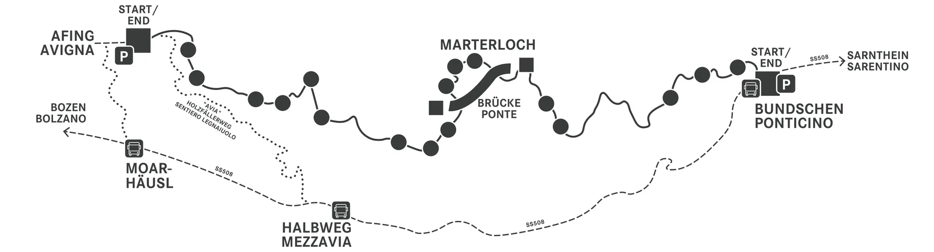
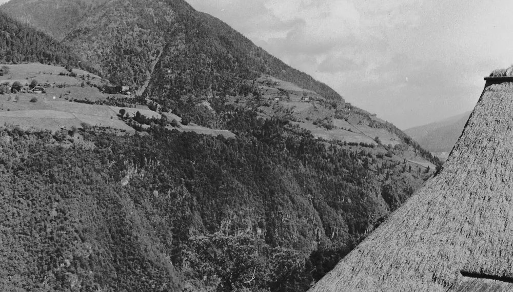
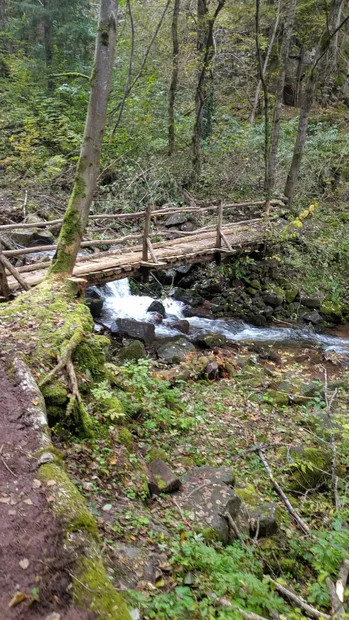
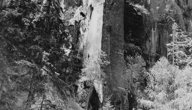
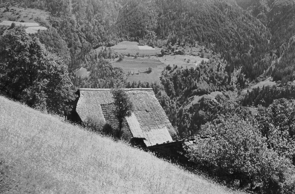
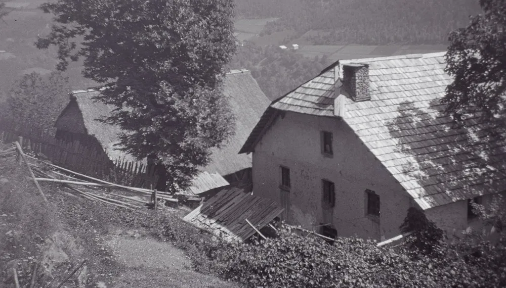
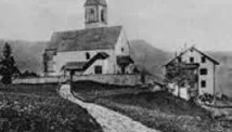
Just above the Marterloch gorge lie the farms of Martertal and Eirnberg (formerly known as "Eyrnberg"). Due to their location along the historic mule track from Bolzano/Bozen to the Sarn Valley, they served for centuries as an important resting place for merchants, carriers, and mule drivers.


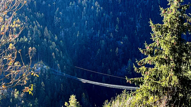
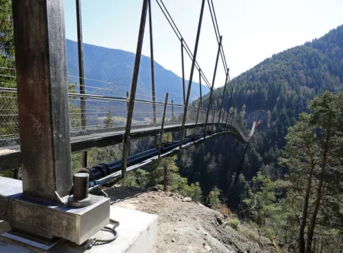
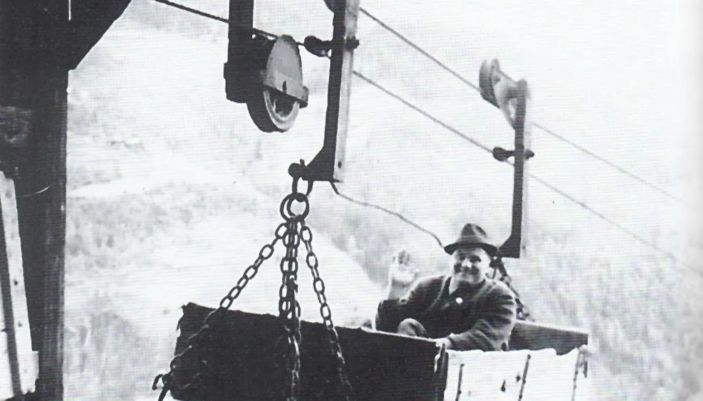
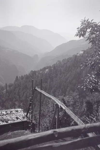
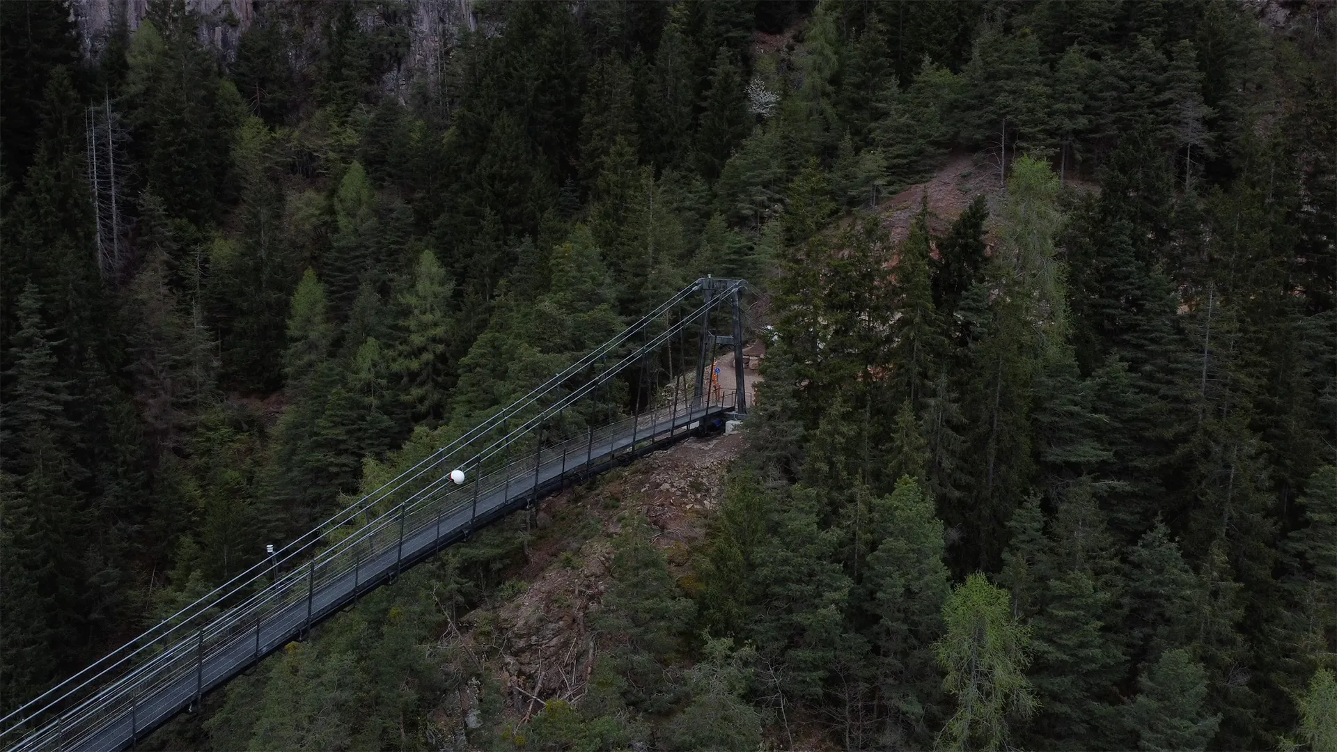
The path led from Bolzano/Bozen via Castle Rafenstein and Afing, through the Marterloch and down to Bundschen and into the valley. A proper road was not built until 1900 – before that, the route along the Talfer River was frequently destroyed by floods and often impassable.


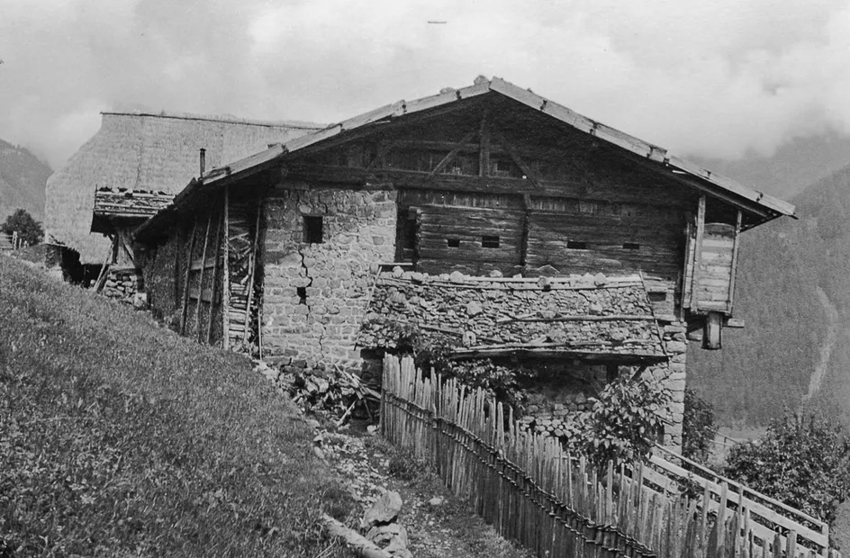
Eirnberg Farm was more than a typical farmstead: featuring a Romanesque archway and a fortified tower with loopholes, the owner was responsible for maintaining the path and was granted the privilege of serving wine. He was also obliged to offer lodging and protection to travelers. The stables could accommodate up to 40 horses.


According to legend, the site was already used during Roman times as a guard post and refuge, allegedly established by the Roman general Drusus.


A Final Greeting at the Martertal Spring

A story inspired by the Sarn Valley


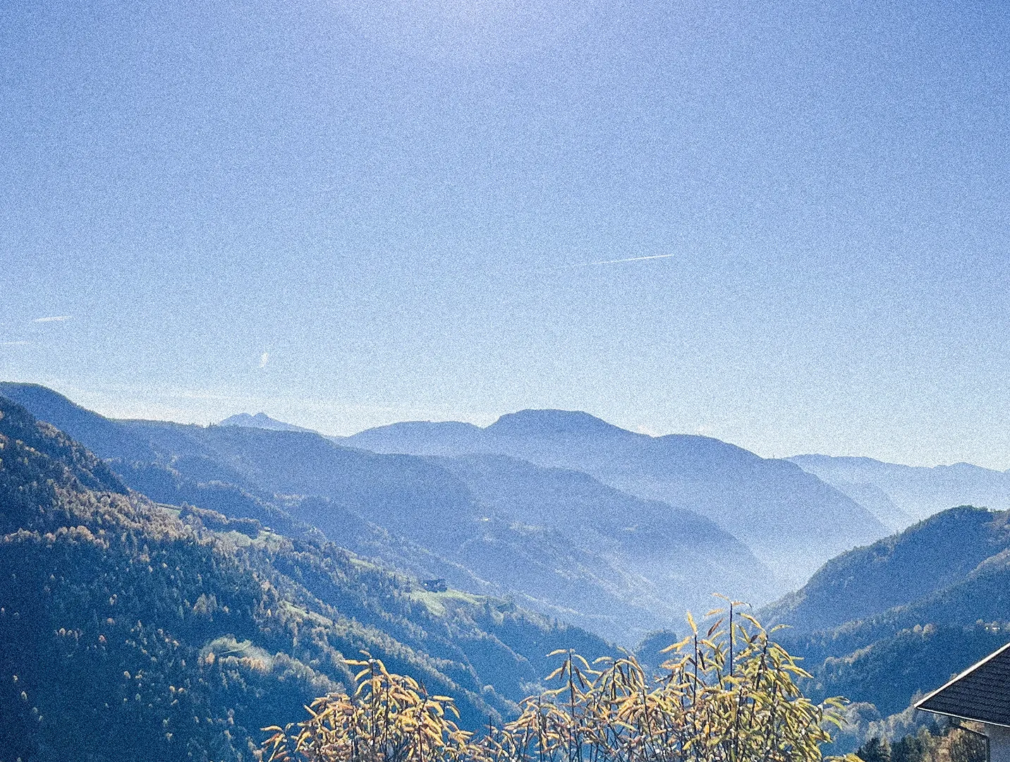
An autumn evening settles cold and quiet over the slopes between Rafenstein Castle and Vormeswald. Along the old mule track, which winds from Bozen through Afing and the Marterloch to Sarnthein, a man walks alone. Time has left its marks on his face. His clothes are worn, the outlines of an old valley costume barely visible. At the spring deep in the gorge, he stops. He sits down, weary, and gazes across at the farm on the opposite side – still and unchanged, like a memory made stone.


It has been ten years since he last drew water here. Ten years since he said goodbye to a young woman named Marta – quiet, blonde, with clear eyes. It was 1810. The valley had to send thirty men to war. The lot fell to his younger brother, but the man at the spring stepped in for him. “Take care of the farm until I return,” he had said. And then he left. With an army bound for Russia. Few returned. He was among them.


Now, in 1820, he is back. Smoke rises from the chimney. The meadows are tended. Nothing seems to have changed. But then a child appears. Blonde, blue-eyed. He says his mother is called Marta, his father Sepp. Four children live at the farm. Sepp – the brother.


The man smiles faintly. He knows there is no place left for him. His sacrifice was silent – and forgotten. In a quiet voice he tells the child: “Tell your mother someone who never forgot her was at the spring today.” Then he turns. Walks the old path down again – through the Marterloch, past Afing, past Rafenstein – and away. For the second and final time.

Info panel 06
Rötegg: Sarner porphyry

Sarntal porphyry is a volcanic rock notable for its light red to pink color. It is quarried nearby at the „Vormeswald“ quarry and is highly resistant to weathering and frost.


Geologically, Sarntal porphyry belongs to the Bolzano quartz porphyry group, found in parts of South Tyrol and Trentino, and is about 270 million years old. It formed from magma that cooled slowly under high pressure near the Earth's surface, resulting in its characteristic porphyritic texture. Its color ranges from gray-white to green, purple, and blue-black but is mostly red — hence the name, derived from the Greek „porphyrus“ meaning purple.


Mining began in the 1980s in the Vormeswald quarry above Obervormeswald and takes place on about 7 hectares using modern methods to carefully extract the stone.


Sarntal porphyry is mainly used in hydraulic engineering for stabilizing banks and slopes, and in building cyclopean walls — large dry stone walls made of irregular stones. Smaller fragments are processed into building stones, larger blocks are cut into slabs of varying thickness. Additionally, porphyry slabs are produced for walkable and drivable surfaces indoors and outdoors.


Thus, Sarntal porphyry is an important regional natural resource whose durability and versatility contribute to the building culture and landscape of South Tyrol.

10,000 cubic meters of porphyry rock had to be blasted for the installation of the water pipeline.
Info panel 07
The suspension bridge over the Marterloch: securing livelihoods and leisure time

With a height of approximately 130 meters above the ground and a span of 272 meters, the suspension bridge over the Marterloch is an impressive engineering feat constructed in 2023/2024. The bridge serves as a pedestrian crossing, connecting both sides of the deeply incised valley, and is optimally designed with a width of 1.20 meters for hikers.


The bridge features a height difference of 9 meters between its two ends, allowing it to harmoniously blend into the landscape. The total weight of the bridge varies between 110 and 145 tons, depending on the water filling of the pipe running beneath it.


Load capacity and safety are ensured by four main cables, each with a diameter of 56 millimeters, capable of supporting up to 215 tons. Each cable is securely anchored with a 30-meter-long anchor embedded in the porphyry rock.


A technical highlight of the bridge is the cast-iron pipe running underneath, with a diameter of 40 centimeters, used for irrigating agricultural land. This pipeline supplies water to around 200 hectares of farmland in the Jenesien area.


Did you know that…?

…the suspension bridge over the Marterloch is 272 meters long?
That’s about as long as 3 football fields lined up!

…the bridge stands about 130 meters above the ground?
That’s as tall as about 20 giraffes stacked on top of each other!

…the two ends of the bridge have a height difference of 9 meters?
That’s almost as tall as a three-story building!

…the bridge weighs between 110 and 145 tons?
That’s as heavy as about 180 to 240 Tyrolean Grey Cows (each weighing around 600 kg)!

…water flows under the bridge at a rate of 100 liters per second?
That’s like dumping 500 big buckets of water every second!

Info panel 08
The old mule track: a dangerous bottleneck

This historic mule track for centuries represented the only connection between Bozen and the Sarn Valley, with generations of people using it for trading purposes. The path through the Marterloch was the only way for the peasants to bring their eggs, fats and other farm produce to Bozen to sell on the market.


On the state of transport in the Sarn Valley
from the Bozner Zeitung, 7 September 1891


We are truly struggling with transport. One still has to pass through the Marterloch with packhorses and donkeys – a dangerous route, especially in winter. A few days ago, a packhorse loaded with various goods belonging to Count Forni fell off the path. The animal died, and most of the cargo was completely ruined.


Everyone wants to build a new road through the valley. There is hope for an interest-free loan of 200,000 florins from the state or empire, to be repaid gradually using increased customs revenues. If the valley is not to remain cut off from the world, such a solution must be considered.


The municipal council and other stakeholders are working tirelessly – especially our postmaster Gänsbacher, mayor Kienzl, and former mayor Gruber. Since the Sarn Valley has to import food for more than half the year, under such transport conditions a famine would not be out of the question.

Excerpt from the Bozner Zeitung, 7 September 1891: The poor condition of the transport route through the Marterloch is criticised – including the report of a packhorse loaded with goods that likely fell at this very spot.
Info panel 09
The Marterloch stream: border and boundary

The stream known as the Marterlochbach runs through here: for several years, from 1810 to 1814, it formed the border between the Kingdom of Bavaria and Italy. In the course of the Napoleonic Wars, in 1805 Austria had to cede the County of Tyrol to Bavaria, which was allied with Napoleon. In 1809 the Tyroleans, under Andreas Hofer, rose up against Bavaria and the French.


The two map excerpts illustrate the following: In 1805, following the Napoleonic Wars, Austria was forced to cede the County of Tyrol to Bavaria, which was allied with Napoleon. In 1809, the Tyroleans rose up against Bavarian and French rule under the leadership of Andreas Hofer. After Austria’s defeat at the Battle of Wagram, the Treaty of Schönbrunn was signed on 14 October 1809. In August 1810, a new border was drawn between the Kingdom of Bavaria and the Kingdom of Italy, making the Marterloch area a border region for nearly four years. Only with the Treaty of Paris in May 1814 did Tyrol return to Austrian rule.

Info panel 10
The abandoned mill

This mill once played a central role in feeding the nearby farms. Grain, essential for bread and other staple foods, was ground here. Many farms possessed a mill and a baking oven from at least the 17th century. In the immediate vicinity of this mill there must also have been a form of wooden roof, a “Schusstenne”, whose purpose was to protect those passing through from falling rocks and the torrent itself. 


Living beneath the water – The Marterloch through 19th-century eyes

Based on Ludwig Steub, “Three Summers in Tyrol” (1846)


The entrance to the Sarn Valley is dominated by a wild ravine – a “grand gorge”, as Ludwig Steub called it. The old path ran high above the streambed along red porphyry cliffs, often without a view into the depths, as the rock plunged steeply below. On the opposite side, rocky ridges and forested slopes unfolded, broken by small cultivated valleys.


Along the same side of the path lies Afing, with its whitewashed houses and the pointed steeple of its church. One hour beyond, Steub writes, “the Marterloch threatens the way” – a narrow crack in the porphyry, with shattered rock and looming overhangs above the traveller’s head. A wooden roof supported by heavy beams protects the trail, and only during rainy periods does a mountain stream flow over it.


Steub imagines how eerie it must feel to walk underneath just as the torrent, swollen by storm, crashes overhead, carrying stones and debris. The locals, he notes with amusement, call it the valley’s “greatest attraction” – because “here, a man can live beneath the water”.


Soon after, the path descends into the valley floor – and with it, the wild drama of the landscape fades. The valley opens, and the traveller enters a gentler, well-inhabited region.

Info panel 11
The descent into the Marterloch: perils and stories

For centuries, the descent into the dangerous gorge of the Marterloch began from here. The linguist and historian Egon Kühbacher wrote: “Many people and animals have died on these steep slopes. The name came about because of these gruesome events and the fears and martyr’s torments that travellers had to endure when crossing the gorge.” Even today, the path through the gorge offers impressively wild and dramatic landscapes, reminding us of the challenges that travellers of old had to face.


Through the Marterloch to Vormeswald

Based on a route description by Johann Jakob Staffler (1844)


Beyond Afing, the old mule track wound its way through steep slopes and tight bends toward the notorious Marterloch – a deep, hollowed-out rocky gorge where the passage was only possible via a wooden footbridge. In spring and summer, torrential floods swept roaring and crashing over this narrow structure; in winter, thunderous avalanches plunged through the ravine.


A narrow, poorly built bridge crossed the Martertal stream, which flowed west to east into the Talfer river. This marked the boundary between the judicial districts of Karneid and the Sarn Valley. To the left, towering red porphyry walls rose skyward among dark pines and firs; to the right, terrifying chasms opened up, unsettling even seasoned travellers. Tragic tales of men and horses falling to their deaths made this place infamous.


Beyond the Marterloch began the Sarn Valley. The steep path continued along the right bank of the Talfer, across unstable, crumbling rock masses, to the first farms of Untervormeswald – six in total, home to 47 people. Further uphill, nestled in the forest, were the scattered farms of Obervormeswald – again six in number, with 36 inhabitants.


This and other vivid historical route descriptions can be found in the book “Auf Sarner Wegen” by Karl Georg Kröss.

Info panel 12
Ropeways: a transport innovation

Before the introduction of motorised vehicles, transporting heavy goods through this steep terrain posed a major challenge. At the beginning of the 20th century, several material ropeways, known as “Bremsen” (brakes), were built in Afing. Originally constructed for transporting timber, these ropeways were soon also used to move goods and people, replacing the historic paths and mule tracks as the main means of transport.


The Bremsen operated using one or two suspension cables, from which the “Wagele” (carriage) – a transport device – was suspended. At the mountain station, the Wagele was guided over rollers and controlled using a braking mechanism attached to the hauling cable, allowing the load to descend in a safe and controlled manner. At the same time, a lighter load could be hauled uphill. With the introduction of motors, the system no longer relied on counterweights: the descent was braked, and the ascent powered by engine force.


The Brems near Hinterschmalz farm is one of the few of its kind still in daily operation today.

Even for passenger transport, the rudimentary cableways were used. Photo: private collection of the Lanznaster family.
Info panel 13
Schmalz: divided and (almost) reunited

For a long time, the Schmalzhof was a single, large farm in Hinterafing. In the middle of the 17th century the farm was divided into the Vorderschmalz and Hinterschmalz: later, the Schmalzgütl (Puhin), Mitterschmalz and Oberschmalz (Tschatterhütt) farms were created, so that eventually five families lived here. The Mitterschmalz and Oberschmalz later merged into today’s Außerschmalz, while the Puhin land was returned to the Hinterschmalz.


The journey to church for the peasants of Hinterafinger was long and arduous: the sacristan in Jenesien was only permitted to start ringing the bells on Sundays once the Hinterschmalzer party was spotted at the Thurner farm.

Info panel 14
Sosberg and Eichrast – places to rest

Below the road stands the Eichrasthof, whose name means “resting place in an oak forest”. The path leads uphill to the Sosberger farm, whose name comes from the Middle High German diu saze, i.e. resting place, hiding place or shelter for wild animals. Two families lived here for over 100 years.


Such places were very important for those travelling the mule track to rest between Bozen and the Sarn Valley.

Info panel 15
Eichrastloch: forces of nature and myths

Alongside the Marterloch, the Eichrastloch (known locally as Hohrastloch) is also an impressively wild gorge where the forces of nature can truly be felt. The upper reaches of the stream are home to the “Höllengånn” and “Menigånn” – large “Steinlammern (boulder fields)” consisting of small and medium-sized boulders created by rockfalls: according to tradition, a hoard of gold is hidden in the Höllengånn. The imposing cliffs of the “Manzklüft” are also to be found here: legend has it that they were created by the sorcerer Manz, who wished to block access to the Sarn Valley by means of a rockfall. These stories and the striking landscape ensure that the Eichrastloch is a place that is evocative both of myths and the forces of nature.


The Wrath of the Sorcerer Manz
How a mighty stormy night taught the people of the Sarn Valley to fear. Based on Gertrud Oberkofler, “Hexen, Salige, Ritter und wilde Mander”, 2008


It is said that the sorcerer Manz was once deeply offended – by none other than the people of the Sarn Valley, who had mocked him. In revenge, he planned to block the valley with a massive rockslide and turn it into a lake. On the peak of Schwarzegg, he is said to have summoned the weather demon – ghostly screams echoed all the way to Furst and Valpigon.


Already on the evening before, the animals were restless, black clouds raced across the sky, and strange things happened around the farms: giant toads crawled along the hollow path, a huge bat circled the house at the Furst farm but never passed the roadside crucifix. At the Graslander farm, a young child suddenly warned the mother that they must pray – the guardian angel had told him.


As night fell, the storm struck: pitch-black clouds rolled in, the wind tore down trees, and the ground cracked open – forming deep ravines and crevices. Only one old weather cross withstood the storm unharmed.


But when church bells began to ring in all the nearby villages – in Afing, Wangen, Jenesien, Kampidell, Flaas and Lafenn – and people lit blessed candles and prayed, Manz lost control over the unleashed forces. One final thunderous crash echoed through the mountains – and the terror came to an end.


The traces of that night remain: north of the Menihof, deep clefts in the rock can still be seen – the Manz Cliffs, shaped by a furious sorcerer and a night that changed everything.

The Manz Cliffs are impressive rock crevices said to have been caused by the sorcerer Manz. Legend has it that he wanted to block access to the Sarn Valley by triggering a rockslide.
Info panel 16
In der Dick: the storyteller and the legends

The Dickerhof is one of the oldest farms in Afing. Its name comes from the Middle High German diu dicke, meaning “thicket” or “impenetrable bushes”. The farm once extended down to the valley floor, where a farm mill was operated on the River Talfer.


From 1812 to 1859, the “Dicker Hansele” lived here – a spirited successor to Till Eulenspiegel and a true master of sharp-tongued humour. Born on 29 February – celebrating his birthday only every four years – he was considered an odd but clever mind from an early age. In Afing, his stories are still told today – often with wonder, always with a smile.


His dry humour was as famous as his quick tongue. When his younger brother “Jaggele” fell from a tree while shaking nuts and lay motionless on the ground, Hansele returned home without concern. Asked by his worried mother where the boy was, he simply said: “He’s outside.” – “Outside where?” – “By the walnut tree.” – “Did he fall?” – “Well, of course.”


He also took instructions literally: once asked to make dumplings, and told “you should be able to manage one”, he did exactly that – one single, enormous dumpling, floating alone in the pot. When his mother scolded him, he replied: “You said: one dumpling.”


His favourite target was the Rapp farmer, owner of the tiniest farm far and wide. Hansele deliberately spread absurd stories, such as that there were so many harvest workers at Rapp that lunch had to be handed down from a cart using a pitchfork – and that among them were Christians, Jews, and Protestants, so numerous were they.


Did all this really happen, or was it just clever invention? Who knows. One thing is certain: the “Dicker Hansele” lives on – as a cunning, eloquent, and unforgettable local character from Afing.

“In the Dek of Hinterafing, the lower farm outside Schmalz” – this is the original caption of the photo by Hugo Atzwanger, taken around 1940.
Info panel 17
Afinger Keschtn – the chestnut tradition

Jenesien (San Genesio) is the municipality with the highest number of chestnut trees in all of South Tyrol. Hinterafing, in particular, is home to a great many – some of them centuries old. In this dry region, chestnuts were deliberately planted as early as the Middle Ages to help farming families survive and to prevent famine. Nutritious and easy to store, chestnuts were once an essential staple food.


The Afing chestnut is a prized local variety known for its particularly sweet and delicate flavour. Its healthy, gluten-free nuts are a beloved part of the traditional Törggelen – the autumn celebration marking the tasting of the new wine.


The wood of the chestnut tree is also highly valued: strong and durable, it has long been used to build pergolas in the vineyards – a lasting example of how this remarkable tree has served both people and the land for generations.

Peeling chestnuts at the Unterbuech farm in 1974. Photo: private.
Info panel 18
Prunnach: fertile land and biodiversity

The Prunnach farm was first mentioned in 1288 under Meinhard II. Its name, meaning “lands rich in springs”, refers to its fertile location with a good water source for cultivating the meadows and fields.


In the late Middle Ages, the farms Außerbrunn, Hinterbrunn and Oberbrunn (Menig) evolved from Prunnach: these “Brunner” farms (their name relates to springs, Brunnen in German) with their favourable locations and fertile soils, have always been sites for cereal and fruit growing. The irregularly spaced orchard trees, preserved to this day and newly planted in recent years, are particularly valuable: they not only provide a habitat for numerous animal and plant species; they are also an important legacy of traditional agriculture.


The Windtearn Makers of Außerbrunn
Folk account from the estate of Fr. Franz Sales Resch († 1971)

Brothers Josef Gabriel and Alois Josef Oberkofler lived with their sister in the Brunnerhäusl on the Afing hill, once part of the Außerbrunn farm. One was a church musician, the other a watchmaker – both known for their craft and good humour.


They became famous for inventing the Windtearn: small lanterns made of folded paper, lit by a candle. In a time without electricity, these lanterns illuminated dark paths and dense forests – a simple yet ingenious invention. The Windtearn was both useful and poetic: a symbol of light in the darkness and the ability to achieve much with little. 


The Brunn brothers would have thrived in the modern world – perhaps building power plants – but they remained faithful to their modest way of life. Their laughter, vitality and inventiveness made them well known far and wide. Visitors never left without a smile. Their playful stories and gentle pranks deserve to be remembered – as a glimpse into the creative, grounded life.

View of Wangen from the Brunn farm. Photo: Hugo Atzwanger, around 1940.
Info panel 19
Harsh living conditions: from “Gråmpen” to farm shop

Life on the steep slopes of the Afing farms was tough. Women known as “Gråmpen” – small-scale vendors in local dialect – supported their families by selling farm produce like pears, chestnuts, mushrooms and berries in Bozen and Sarnthein. For generations, the mule track through the Marterloch gorge was their only route to market. Along the trail, you can still spot “Gråmpenrast” stones – resting spots for these women before the steep descent.
Today, local products are sold directly in farm shops – a modern echo of this long tradition.


The Gråmpen
Based on a story by Luis Oberkalmsteiner from 1968


In the Sarn Valley, a special tradition lives on: the Gråmpen. These farm women walk to Bolzano with baskets or „zögger“ full of homemade goods – butter, cheese, wool, eggs, ointments – to sell at the weekly market. Their work is not just economic; it’s a bridge between rural life and city needs.

They move between the farm and the city, rarely at home, delivering goods to regular clients in Bolzano. They run errands, deliver photocopies, letters or medicine, and often bring news – including the latest gossip from the valley.

The weekly market is their stage: a lively blend of Sarner costumes and urban practicality. They speak Sarner dialect fluently and use gestures where words fall short. Skilled negotiators, they do their math in their heads – or consult their husbands if needed.

Being a Gråmpin is a hard life, rich in tradition but light in wealth. Even the legendary “Mèsnerkatl,” long considered the informal president of the Gråmpen, was better known than well-off.

The women, known as “Gråmpen” (a dialect term for small-scale vendor or fruit seller), contributed to the family income by selling pears, chestnuts, mushrooms, and berries in Bozen and Sarnthein. Photo: private.
Info panel 20
Afing - Remote, yet connected

From this point, your hike leads into the dramatic gorge of the Marterloch and across its striking suspension bridge – along a historic mule track that once connected Bolzano to the Sarn Valley. 


Please stay on the marked trails and do not leave litter behind.


The name “Afing” derives from the Latin avia, meaning a remote or isolated place. And indeed, Afing was hard to reach for centuries – but never truly cut off. The area, stretching from the Talvera gorge to the uplands of Schwarzegg, is crossed by the Afing stream (also called Dorner Brook) and the Moar-Bachl. Chestnut groves, meadows and alpine pastures still reflect the region’s small-scale mountain farming.


One of the most important historical routes from Bolzano to Sarnthein ran through this area. It began near the Talvera bridge at the “Badlwirt” inn – close to today's Victory Monument – and led past St. Anton and Rafenstein Castle into the Marterloch gorge and onward into the Sarn Valley. It was more than just a footpath: pack animals, ox-drawn carts and local traders used it regularly. Deep wheel ruts carved into the stone paving are still visible – a lasting sign of how vital this mountain route once was.

Postcard view of Afing from the time before a road led to the village. Photo: private collection.

Tips for a sustainable visit

Use public transport, as the road to the farms is narrow and has hardly any passing places. There are no car parks up towards the Marterloch.


Bike racks are available for e-bikes at both ends of the bridge, so you can leave your bike safely locked up and explore the gorge and the bridge on foot.


Stay on marked paths and do not leave any rubbish behind.


Good footwear and a head for heights are strongly recommended!

Your way to the Marterloch Adventure Trail

Easy to reach

Plan your journey to Bundschen/Ponticino or Afing/Avigna and discover the Marterloch Adventure Trail. Whether on foot, by bike, or using public transport, the route is as varied as the destination itself. Explore the picturesque surroundings and experience South Tyrolean nature up close.